After a good day of rest in Hamburg it was time to mount the bike again. The goal of this rather cloudy Sunday was Hannover, close to 200 km South of the Hanseatic city at the Elbe river. And the Elbe was my first waypoint.

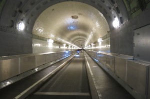
There are several ways of crossing the Elbe. I chose going under it via the old St. Pauli Elbtunnel. Build in 1911 and with a length of 426.5 meters it connects the city with the extensive harbour area on the other side. Cars are allowed at certain times, but on Sundays it is only accessible on foot or on a bike. It was cool and quiet. Two lifts made going down and up effortless. Continue reading On a bike to Amsterdam – part #2

